What Westport is
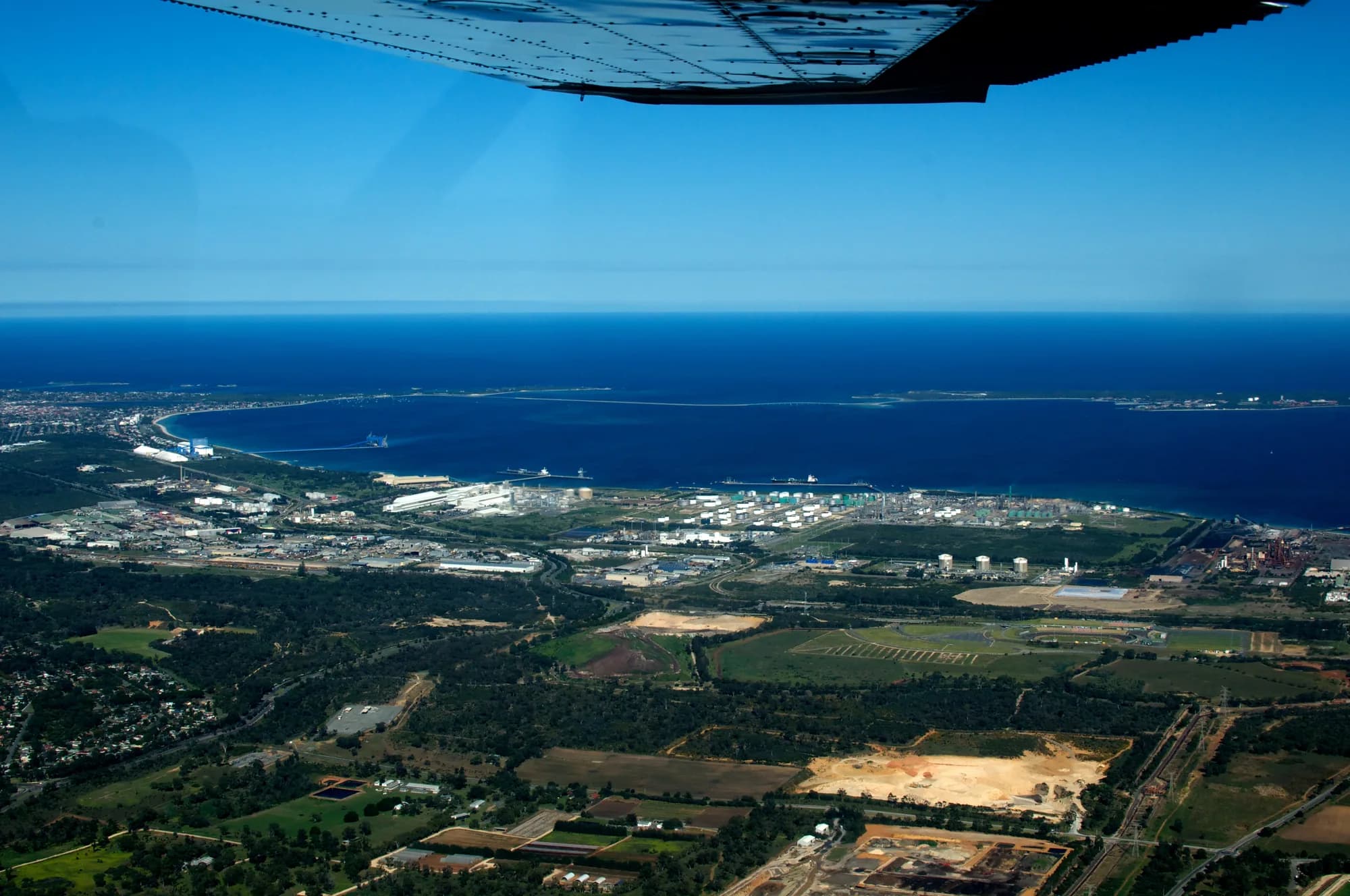
Western Australia’s container trade currently runs through Fremantle Harbour, at the mouth of the Swan River. Westport is a state government project, costed at AUD $7.2 billion, to move that trade about 12 miles due south to Kwinana, on the eastern shore of Cockburn Sound.
The project was conceived and announced before AUKUS existed. The trilateral agreement between Australia, the United Kingdom and the United States was announced in September 2021, after the port relocation was already state policy. Nothing about Westport was designed around the presence of allied nuclear submarines, because when it was designed there were none.
- Where the container ships berth
- Today
Fremantle Harbour, at the mouth of the Swan River. Outside Cockburn Sound.
Once Westport is builtKwinana, on the eastern shore of Cockburn Sound. Inside it.
- How close they come to the submarine base
- Today
The berths are not on the sound. Container ships and submarines do not share that water.
Once Westport is builtAbout 3.7 miles across the water from HMAS Stirling. Vessels waiting at anchor can sit closer.
- The sound’s single navigable entrance
- Today
Carries naval movements and the state’s imported fuel.
Once Westport is builtCarries the container trade as well. Movements through it are projected to more than double.
Where it sits
Cockburn Sound is a body of water roughly 12 miles long. Garden Island forms its western side and carries HMAS Stirling, also called Fleet Base West, along with the Royal Australian Navy’s western weapons facility and store. The mainland forms the eastern side, and that is where Kwinana is.
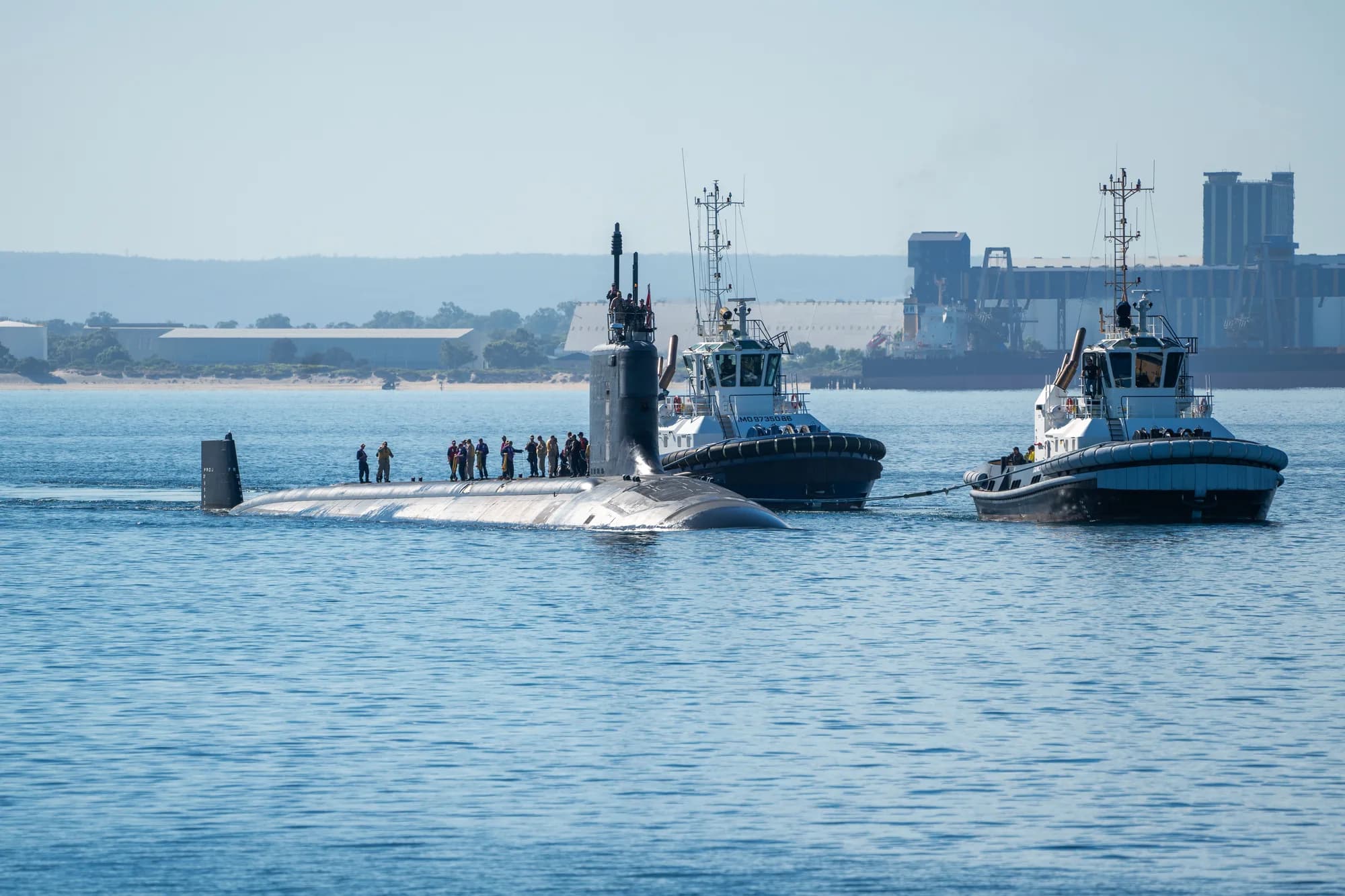
Under AUKUS, HMAS Stirling is the base at which United States Virginia-class submarines will rotate, alongside British boats, as Submarine Rotational Force West. The relocation puts commercial container docks roughly 3.7 miles from that base, directly across the sound. Vessels waiting at anchor for a berth can sit closer than 3.7 miles.
The single channel
Cockburn Sound has one navigable entrance. Its northern end is flanked by narrow and shallow water, reached by transiting Gage Roads. Its southern end is not navigable by anything larger than small recreational craft, and access to HMAS Stirling itself is by a causeway from the mainland.
That means one channel carries everything. Submarine movements and commercial movements use the same water, at the same depths, in the same confined space. Once Westport is operating, shipping movements through that channel are projected to more than double, because traffic that berths at Fremantle today would berth at Kwinana instead.
A submarine transiting a narrow channel has little sea room and little depth in which to manoeuvre. That is the condition the assessment describes as a bottleneck, and it is the condition Westport creates by design rather than by accident.
The crossing conflict
The shared entrance is the half of the problem that is easy to state. The other half is what happens once a ship is inside.
HMAS Stirling sits on Garden Island, on the western shore. The submarine maintenance facility planned for those boats is at Henderson, on the mainland shore to the north. A submarine moving between the base and its maintenance facility therefore crosses Cockburn Sound, from one side to the other. It is a routine movement, it is a movement nobody can reschedule around, and it happens in water the sound does not have much of.
The commercial shipping channel runs the length of that same water, from the single entrance in the north down to the terminal Westport proposes at Kwinana. The two routes are not parallel. They intersect. Every foreign-flagged container ship inbound to or outbound from the new terminal would cross the route allied nuclear submarines use to reach their own maintenance facility.
That is the crossing conflict, and it is a separate fact from the 3.7 miles and from the shared entrance. A wider entrance would not remove it. A second channel would not remove it. It is created by putting the terminal on the far side of a route the submarines have to use, and it is removed by putting the terminal somewhere else.
Why the shipping matters
What the traffic is made up of matters as much as how much of it there is, and that composition is not going to change.
The retired officers who wrote the August 2025 assessment place this in the context of what 2025 demonstrated about containerised weapons. Ukraine’s Operation Spiderweb moved drones into Russia inside shipping containers and launched them remotely against airfields. Israel established drone launch sites inside Iran by comparable methods. The common feature is that the weapon is delivered to the target country by ordinary commercial means and launched from inside it, which removes most of the warning a defence system depends on.
Applied to Cockburn Sound, that means a weapon system carried in a container aboard a foreign-flagged vessel, in the vicinity of the base or of a submarine in transit through a channel with no room to manoeuvre.
The blockage problem
The second risk is simpler and does not require an adversary at all. A single large vessel grounding in the channel, whether through mechanical failure, navigation error, weather, or deliberate action, closes it. What makes that serious is not any one of the consequences but the fact that they arrive together.
- Ever Given, Suez Canal, 2021
- One grounded container ship closed the waterway.
- MV Rena, New Zealand, 2011
- Carrying 1,368 containers. Roughly six weeks before the first container was lifted off. The offload took six to seven weeks. Environmental recovery ran for months.
The same event that traps the submarines cuts the state’s supply chain, and clearing a channel is not quick. A second channel would reduce the risk from an accidental blockage, though not from a deliberate one, which could be attempted in both channels at once.
What has not been shown
The assessment’s central point is not that these risks are unmanageable. It is that no one has shown they have been assessed. Westport predates AUKUS, and the public record does not contain a risk analysis of the relocation conducted in light of what AUKUS brought to Cockburn Sound.
The questions the authors put to the Australian Minister for Defence are on the record, and unanswered.
- What risk assessments were conducted on the relocation of the container terminal?No answer published
- What consultation took place with national security and intelligence agencies?No answer published
- Was a threat assessment done on weaponised merchant shipping operating near HMAS Stirling?No answer published
- How will foreign-flagged vessels be screened before they enter Cockburn Sound?No answer published
- What happens if the single channel into the sound is blocked?No answer published
For an American reader, the relevant fact is that those questions concern a base the United States is investing in, and they are being answered, so far, by a state government that has called the concerns wrong.
Read the underlying documents
Everything on this page comes from published sources, listed in full on the Evidence page. The state government’s own responses are quoted and answered on What They Say.
Share this page
Help this reach more people who can act on it.